Agriculture and Energy Network Update for Friday, March 13, 2026
Operational Performance
Overall network conditions remain solid. While weather systems across portions of our network last week introduced some performance variability, operating teams have continued to deliver steady service. Across the Northern Corridor and portions of the Plains, changing weather conditions have resulted in localized service interruptions, including heavy rain and flash flooding, isolated tornadoes and very high winds. Yesterday, particularly across the Northern Corridor, severe winds downed trees and power lines in some areas, with wind gusts reaching up to 70 mph across parts of the Northern and Central Plains.
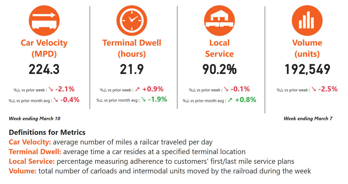
These recent weather events have contributed to some temporary impacts to our service performance metrics. Car velocity is down compared with the prior week but remains consistent with average February levels. Terminal dwell is slightly elevated week over week, but has improved from last month’s average, while local service performance remains strong at 90%.
Service Expectations for the Week Ahead
Some weather activity will continue across the BNSF network through the weekend. A Pacific storm system is bringing periods of heavy rain and mountain snow to the Pacific Northwest and northern Rockies. Meanwhile, a late-season winter storm is expected to develop across the northern High Plains tonight into Saturday, bringing the potential for heavy snow and strong winds before strengthening as it moves toward the Great Lakes by Saturday.
Our teams are actively monitoring conditions and are ready to respond as needed to support safe and efficient network operations.
As always, we thank you for your business and appreciate the opportunity to serve as your transportation service provider. We welcome your feedback and questions.